Orthomosaic Mapping for Large Acreage Properties in Florida
When a property spans dozens or hundreds of acres, a standard aerial photo isn't enough. Orthomosaic mapping gives buyers, sellers, and landowners a complete, measurable picture of the land.
Florida has some of the most diverse land in the country — from Gulf Coast marshes and river bottomland to upland pine forests, cattle ranches, and agricultural tracts. When you're selling, buying, or documenting a large acreage property, a single aerial photo doesn't tell the whole story.
Orthomosaic mapping does.
What an Orthomosaic Shows That a Photo Can't
A standard aerial photograph captures a moment from a single vantage point. It shows what the land looks like, but it can't tell you how big it is, where the boundaries run, or how the different parts of the property relate to each other.
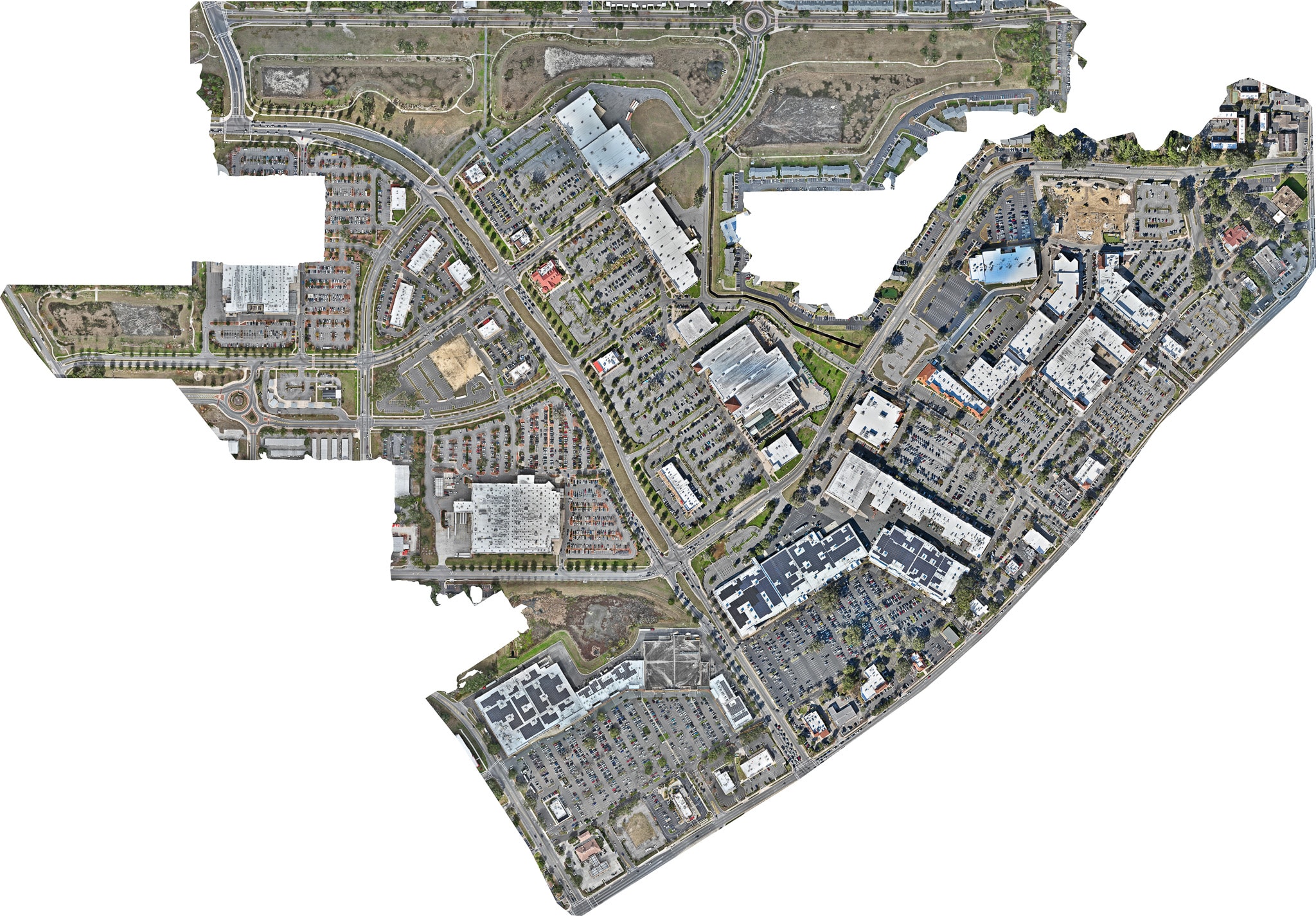
An orthomosaic map is different. Because it's built from hundreds of overlapping images stitched together into a single georeferenced map, it shows:
- True scale — the actual size of the property, accurately represented
- Spatial relationships — how the home, outbuildings, water features, and land improvements relate to each other
- Boundary context — where the property sits relative to roads, neighboring parcels, and natural features
- Measurable distances — buyers and agents can measure distances and areas directly from the map
Applications for Florida Land
Farms and Ranches Show the full extent of pastures, paddocks, water sources, and agricultural infrastructure. Buyers evaluating a working farm need to understand the layout before they visit.
Timberland and Recreational Property Timber tracts and hunting properties often have complex layouts — multiple stands, food plots, roads, and water features. An orthomosaic gives buyers a complete picture.
Waterfront and River Properties Florida's rivers, lakes, and coastal marshes create some of the most visually compelling land in the country. An orthomosaic captures the full relationship between the land and the water.
Development Land Developers evaluating raw land need to understand existing conditions — drainage patterns, vegetation, access, and topography. Orthomosaic mapping provides a reliable baseline.
Delivering More Than an Image
Sky Monkey Media delivers orthomosaic maps as high-resolution images and, when requested, as interactive online maps that allow buyers, agents, and landowners to zoom, pan, and measure directly in their browser.
Instead of emailing a large file, you send a link. The buyer can explore the property from their desk before ever scheduling a visit.
For large acreage listings throughout Florida, orthomosaic mapping is one of the most effective tools available. Contact us to discuss your property.