
Drone Mapping for Real Estate: Beyond Photography Into Precision Data
Drone mapping goes beyond aerial photography to produce GPS-accurate site plans, topographic data, and boundary overlays that give buyers and developers the precise information they need.
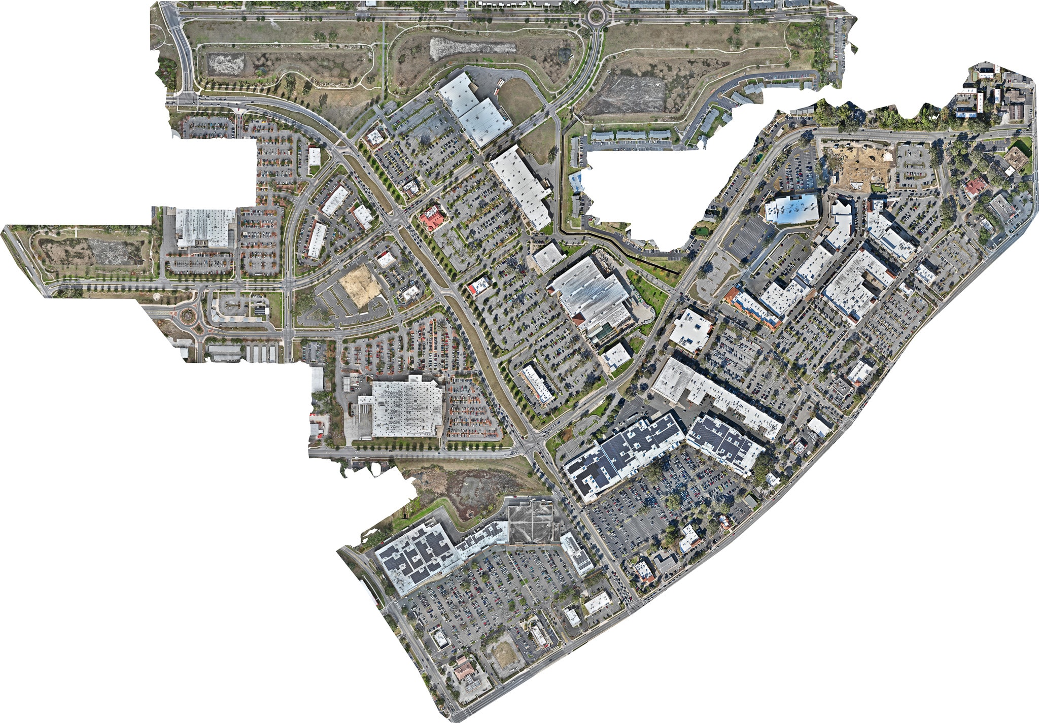
Most people think of drone photography as a tool for capturing beautiful aerial images. And it is. But the same technology that produces stunning listing photos can also generate something far more precise: GPS-accurate maps, site plans, and topographic data that give buyers, developers, and agents information that no photograph can provide.
Drone mapping is the process of flying a drone in a systematic grid pattern over a property, capturing hundreds of overlapping images that are then processed by specialized software into a georeferenced map of the site. The result is not a photo — it is a data product.
What Drone Mapping Produces
A drone mapping mission over a typical North Florida property can generate several distinct deliverables:
Orthomosaic maps — A seamless, geometrically corrected aerial image of the entire property, accurate to within a few centimeters. Unlike a standard aerial photo, an orthomosaic is a true map — distances and areas can be measured directly from the image.
Digital elevation models (DEMs) — A 3D representation of the terrain that shows the topography of the land, including slopes, drainage patterns, and elevation changes. Critical for agricultural properties, development sites, and flood-prone areas.
Point clouds — A three-dimensional dataset of millions of individual measurement points that can be used to create precise 3D models of structures and terrain.
Boundary overlays — GPS-accurate property lines overlaid on the orthomosaic, giving buyers a clear visual reference for exactly where the property begins and ends.
Applications in Real Estate
Acreage and Land Sales
For large parcels, drone mapping provides buyers with the precise information they need to evaluate a purchase. A 50-acre horse farm in Marion County is a complex piece of real estate — the buyer needs to understand the topography, drainage, soil conditions, and infrastructure layout before making an offer.
A drone map with boundary overlays and elevation data answers these questions definitively, reducing the due diligence period and increasing buyer confidence.
Development Site Analysis
Developers evaluating raw land for residential or commercial development use drone mapping to assess the site before committing to a purchase. The topographic data reveals drainage challenges, buildable area, and infrastructure requirements that are invisible from the ground.
Construction Documentation
During active construction, drone mapping provides a precise record of site conditions at each phase of the project. This data is valuable for project management, contractor coordination, and dispute resolution.
Commercial Real Estate
For commercial properties with large parking lots, loading docks, and complex site infrastructure, drone mapping provides a precise site plan that supports lease negotiations, tenant fit-out planning, and property management.
The Difference Between Mapping and Photography
A standard aerial photo is a perspective image — it looks like what you would see from a helicopter window. It is visually compelling but geometrically distorted. Objects near the edges of the frame appear to lean outward, and distances cannot be accurately measured.
An orthomosaic map is geometrically corrected — every point in the image is in its true geographic position. It is essentially a photograph that has been transformed into a map. You can measure the distance between two fence posts, calculate the area of a paddock, or determine the setback from a property line with the same accuracy as a traditional survey.
FAA Compliance and Data Accuracy
All Sky Monkey Media drone mapping operations are conducted by FAA Part 107 certified pilots using professional-grade mapping drones equipped with high-accuracy GPS receivers. Our deliverables meet the accuracy standards required for real estate marketing, construction documentation, and preliminary site analysis.
For applications requiring survey-grade accuracy — legal boundary determinations, engineering design, or regulatory submissions — we recommend pairing our drone mapping data with a licensed land surveyor's review.
Contact us to discuss how drone mapping can support your next large-acreage listing, development project, or construction documentation need.
Explore Topics
Written by
Sky Monkey Media
Content creator and writer sharing insights and stories.