Beyond the Roof Shot: 3 Strategic Drone Angles That Sell the Location, Not Just the House
The straight-down roof shot is the most overused drone angle in real estate photography. Here are three strategic aerial perspectives that actually move listings in North Florida.
Beyond the Roof Shot: 3 Strategic Drone Angles That Sell the Location, Not Just the House
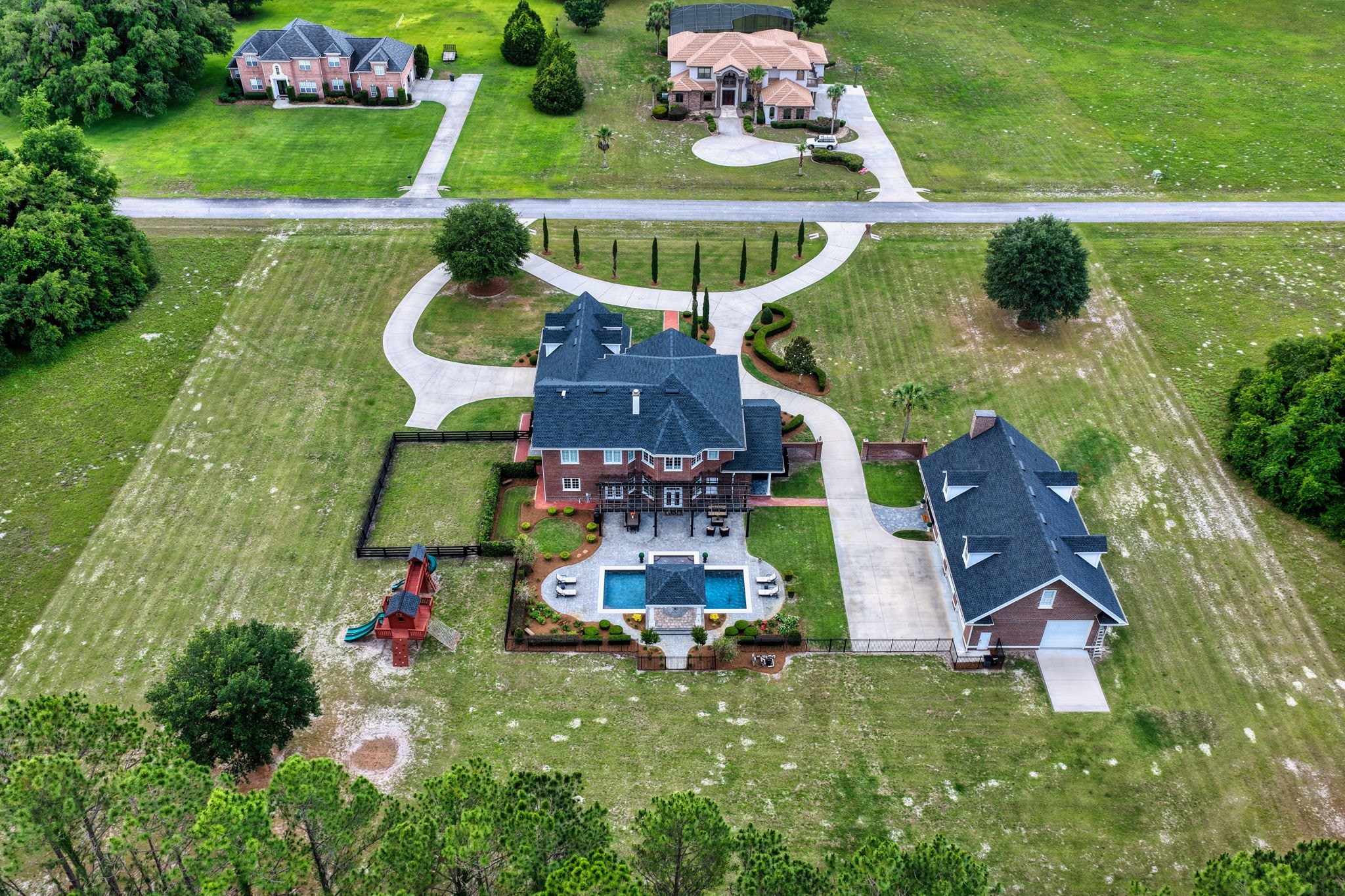
Ask most people what drone photography looks like in real estate, and they will describe the same image: a straight-down shot of a roof surrounded by a yard. It is the most common drone angle in listing photography — and often the least effective.
The straight-down nadir shot has its place. It communicates lot shape, roof condition, and basic property boundaries. But it does almost nothing to sell the location — the neighborhood, the water access, the proximity to amenities, the lifestyle that comes with the property.
Here are three strategic drone angles that go beyond the roof shot and actually move listings.
1. The Oblique Reveal
The oblique angle — typically shot at 30 to 45 degrees from horizontal — is the workhorse of effective real estate drone photography. It combines the aerial perspective with enough horizontal context to tell a complete story about the property and its surroundings.
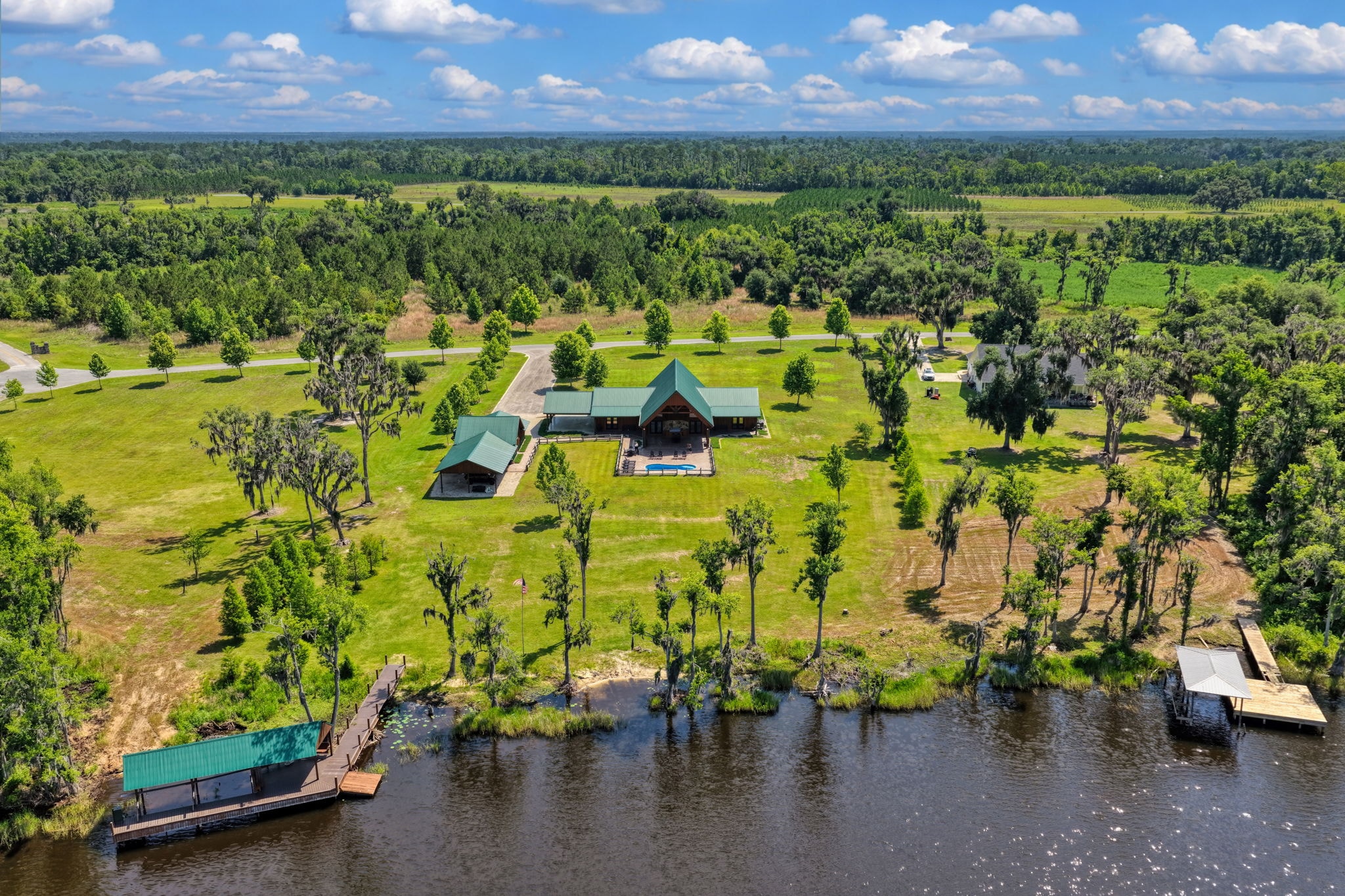
What it communicates: The home's relationship to its lot, the neighborhood context, and any nearby amenities or natural features. A well-composed oblique shot of a waterfront property can show the home, the yard, the dock, the water, and the surrounding landscape in a single frame.
When to use it: For virtually every listing where location context matters — which is most listings in North Florida. The oblique reveal is particularly powerful for:
- Waterfront and riverfront properties where the water is visible in the background
- Properties with exceptional landscaping or outdoor living areas
- Homes in distinctive neighborhoods where the surrounding streetscape adds value
- Rural properties where the relationship between the home and the land is a selling point
Technical note: The oblique angle requires careful attention to lighting direction. Shooting with the sun behind the drone (front-lit subject) produces the cleanest, most detailed images. Side lighting creates dramatic shadows that can add visual interest but may obscure important details.
2. The Proximity Context Shot
The proximity context shot is specifically designed to answer one question: "How close is this property to [the thing that makes it valuable]?"
For a riverfront property, the proximity context shot shows the home and the river in the same frame, with enough altitude to make the relationship between them immediately clear. For a property near a spring, it shows the home and the spring run. For a property in a golf course community, it shows the home and the fairway.
What it communicates: The specific lifestyle amenity that justifies the property's price point. This is the shot that converts a browser into a showing request.
When to use it: Any time the property's value is significantly tied to its proximity to a specific feature — water, parks, schools, commercial amenities, or natural landmarks.
Execution: This shot typically requires more altitude than the oblique reveal — sometimes 200 to 300 feet — to capture both the property and the contextual feature in the same frame. It also requires careful composition to ensure the relationship between the two elements is immediately legible.
In North Florida, the proximity context shot is particularly valuable for properties near:
- The Suwannee River and its tributaries
- Crystal River and the Kings Bay manatee sanctuary
- Ichetucknee Springs and the spring run corridor
- Gulf Coast access points in Levy County and Citrus County
- State parks and wildlife management areas
3. The Boundary and Scale Shot
For large acreage properties, the boundary and scale shot is often the most important image in the entire listing gallery. It answers the question that no ground-level photo can: "How big is this property, and what does all of it look like?"
What it communicates: The full extent of the property's acreage, the distribution of cleared versus wooded land, the location of outbuildings and infrastructure, and the overall character of the land.
When to use it: Any listing with more than 2 acres where the land itself is a significant part of the value proposition. This includes:
- Agricultural and ranch properties in Alachua, Columbia, Hamilton, and Gilchrist counties
- Timber and hunting tracts throughout North Florida
- Waterfront acreage where the extent of river or lake frontage matters
- Development parcels where the buildable area and infrastructure need to be communicated
Execution: The boundary shot typically requires the highest altitude of any real estate drone shot — often at or near the FAA's 400-foot AGL limit — and may require multiple overlapping frames to capture the full extent of large properties. For very large tracts, a composite aerial image or a drone mapping overlay may be more effective than a single shot.
The Complete Aerial Package
The most effective listing photography combines all three of these angles with a standard exterior front shot and interior photography to create a complete visual story.
- Oblique reveal → Establishes the property's character and setting
- Proximity context → Communicates the lifestyle value of the location
- Boundary and scale → Answers the "how big is it really?" question for acreage properties
- Exterior front → Provides the standard MLS hero image
- Interior gallery → Closes the showing request
Sky Monkey Media plans every aerial shoot with these strategic angles in mind, ensuring that the drone footage we capture tells the complete story of your listing — not just what the roof looks like from above.
Ready to elevate your listing with strategic aerial photography? Book your shoot today.
Explore Topics
Written by
Sky Monkey Media
Content creator and writer sharing insights and stories.